Tropical Watch: Gulf Coast Faces Possible Development, NHC Issues Alert
Potential Tropical System Off Southeastern US Coast Brings Heavy Rain and Coastal Risks
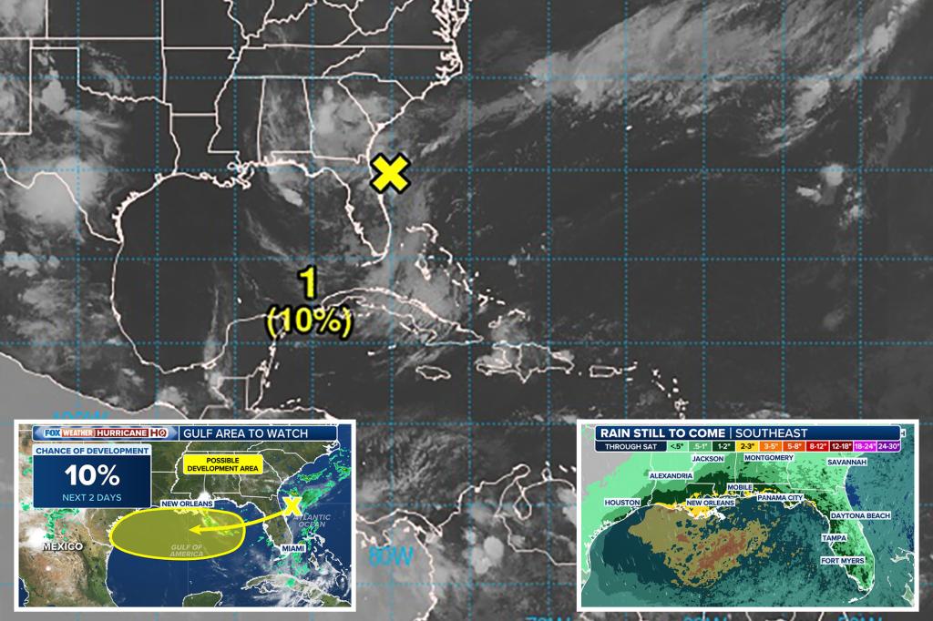
A weather disturbance off the southeastern US coastline is under observation for possible development into a tropical system, although chances remain low.
Similar to an earlier event known as Invest 93L, a trough of low pressure at the southern end of a frontal boundary is expected to drift west-southwest into the northern Gulf of Mexico. While environmental conditions could allow for slow development if the system stays offshore, it is forecast to move inland by the weekend, reducing the likelihood of further development.
The primary concern remains heavy rain and thunderstorms, with forecast rainfall totals of 2 to 3 inches across much of the northern Gulf Coast, and locally higher amounts possible. While widespread flooding isn’t expected, isolated areas may experience flash flooding if heavy rain persists over the same spot for an extended period.

The system’s less organized structure compared to Invest 93L suggests a lower chance of significant development, but the persistent southerly flow along the Gulf remains a concern for coastal residents and visitors.
Additionally, the ongoing flow raises the risk of rip currents along beaches. A moderate risk is expected from the Florida Panhandle through the Atlantic coast, from Destin to West Palm Beach, through the end of July.

Already, parts of the South Carolina Low Country have experienced flooding, particularly around Charleston. Heavy rains and high tides caused streets to flood, with over an inch of rain falling in Charleston on Monday. Minor saltwater flooding was observed in Charleston Harbor on Tuesday, and such impacts might continue until the system moves through the Gulf region.
