Tropical Storm Chantal Forms Off South Carolina Coast
Storm Chantal Forms Off South Carolina Coast with Heavy Rain Threat
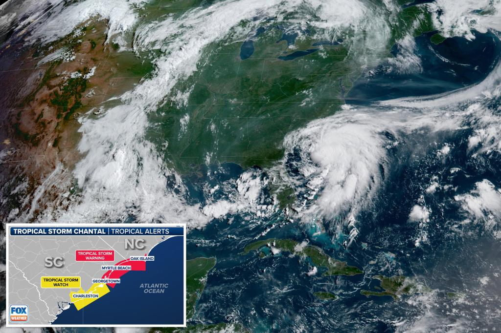
A new tropical storm, Chantal, has developed off the coast of South Carolina, prompting warnings across the region. Currently with maximum sustained winds of 40 mph, the storm is located about 150 miles southeast of Charleston and moves slowly northward at 2 mph.
Forecasts suggest that Chantal will strengthen slightly today before making landfall along the northern South Carolina coastline early Sunday morning. The primary concern is heavy rainfall; projections indicate the storm’s center will hit shores north of Folly Beach late tonight or early Sunday, bringing substantial rain accumulations.
Widespread heavy rain is expected to impact the coastal plains of the Carolinas through Monday, with totals reaching 2-4 inches in many areas—and isolated spots potentially seeing up to 6 inches, according to the National Hurricane Center (NHC). Additionally, a minor storm surge of about 1 to 3 feet in the warning zones and 1 to 2 feet in the watch areas is expected, along with dangerous rip currents and elevated surf conditions.
Storm surge combined with high tides may cause minor coastal flooding in normally dry areas, especially in regions vulnerable near the shoreline. Beachgoers are advised to stay cautious as life-threatening rip currents are likely to persist along affected beaches.


