Breaking: Tropical Storm Andrea Becomes First Named Storm of the Atlantic Season—You Won’t Believe What’s Coming Next!
Tropical Storm Andrea Forms in the Central Atlantic
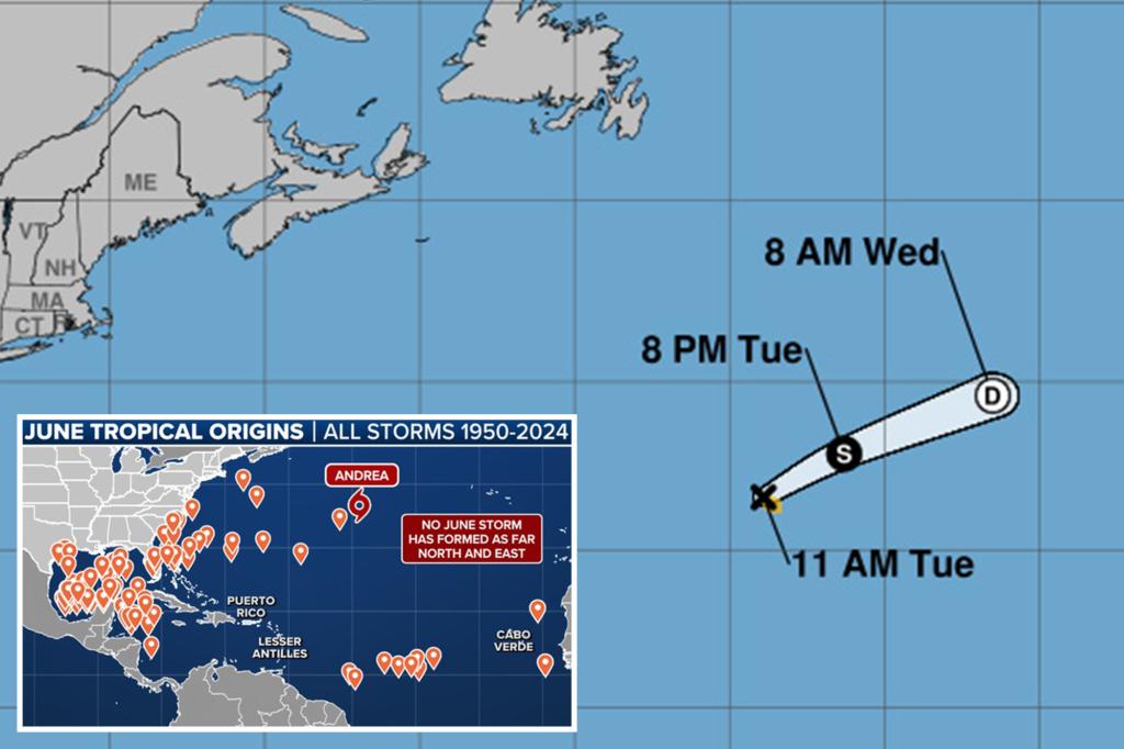
The first named storm of the 2025 Atlantic hurricane season, Tropical Storm Andrea, has developed in the central Atlantic Ocean on Tuesday morning.
The National Hurricane Center (NHC) reported that the system, previously identified as Invest 90L, became well-organized with sustained winds of 40 mph, qualifying it as a tropical storm. Tropical storms are characterized by maximum sustained winds ranging from 39 to 73 mph.
Currently, Andrea is approximately 1,200 miles west of the Azores and is moving northeastward at about 15-20 mph over open waters. The storm is expected to gradually weaken beginning Tuesday night and is projected to dissipate by Wednesday night. Importantly, Andrea poses no threat to land, remaining over the open ocean.


Remarkably, Andrea is making history as the most northern and eastern June tropical system in the Atlantic since records began in 1851. While it doesn’t threaten land, the storm has set a notable record in the hurricane season’s early days.