Tropical Storm Jerry Nears Atlantic — Priscilla Approaching Baja Peninsula
Storm Activities in the Pacific and Atlantic Oceans
Recently, Tropical Storm Priscilla lost its hurricane strength while tracking along Mexico’s western coast, weakening from a major hurricane to a tropical storm. Currently, Priscilla is approximately 270 miles west of Baja California’s southern tip, moving northwest at 8 mph with sustained winds of about 50 mph. The storm is expected to bring high surf, gusty winds, and heavy rainfall to Baja California Sur, which is under a tropical storm watch from Cabo San Lucas to Cabo San Lazaro. Rainfall amounts between 2 and 4 inches may lead to flash flooding as the storm progresses along Mexico’s Pacific coast through the weekend.

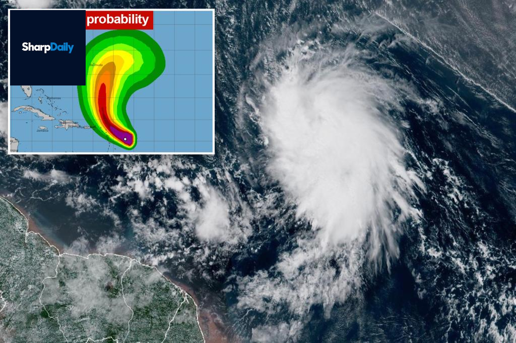
Meanwhile, Tropical Storm Jerry is strengthening in the Atlantic with its center about 395 miles east-southeast of the Leeward Islands, moving west-northwest at 20 mph with top winds of 65 mph. The storm is expected to gradually intensify, potentially becoming a hurricane by the weekend. Forecasters warn that 2 to 4 inches of rain could fall across the Leeward Islands into Thursday and early Friday, raising flash flood concerns.

An alert remains in effect for regions including Antigua, Barbuda, Anguilla, St. Kitts, Nevis, Montserrat, St. Barts, St. Martin, Saba, and St. Eustatius, indicating the potential impact of the storm. In the Pacific, Tropical Storm Octave weakened below hurricane strength but stayed active early Thursday. Located about 430 miles south-southwest of Baja California, Octave is moving east-northeast at 18 mph with winds of 40 mph. It poses no immediate land threat and is expected to dissipate soon.