East Coast Tornado Threat: NYC, Philly & D.C. Brace for Severe Storms & Heavy Rain
Widespread Rain and Storm Threats Along the East Coast
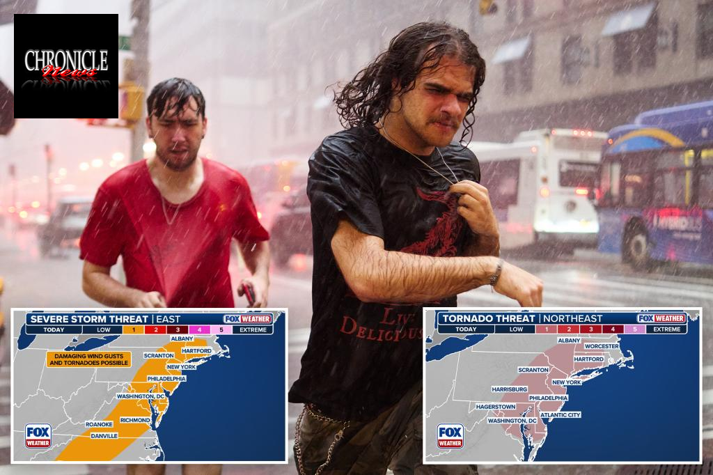
A cold front advancing through the region is expected to trigger widespread rainfall and thunderstorms across the Interstate 95 corridor in the Northeast and mid-Atlantic on Thursday. Major cities such as New York City, Philadelphia, and Washington D.C. face the possibility of severe weather, including tornadoes.
Most thunderstorms will be isolated or pop-up types, with some possibly reaching strong to severe intensity. The main risks include damaging winds, flooding rain, and lightning, with a potential for tornado formation in certain storms. Forecast models indicate rainfall totals could reach up to 3 inches in parts of eastern Pennsylvania and southwestern New England, with localized areas experiencing even higher totals where storms repeatedly pass over the same region.
While the overall atmospheric conditions may not support a full-scale severe weather outbreak, powerful storms are still possible. The Storm Prediction Center has placed tens of millions of people from southern New England through the Northeast and into the mid-Atlantic under a Level 1 (out of 5) risk for severe thunderstorms.

Additionally, roughly 45 million residents from western Massachusetts to the Delmarva Peninsula are at risk of tornadoes, including those in Springfield, Hartford, New York City, Philadelphia, Baltimore, and Washington.
An issue to watch is localized flooding, especially in urban areas with poor drainage, where storms may repeatedly track over the same spots—a phenomenon known as training. This could lead to standing water on roads, causing travel disruptions late into the night and early morning.

Some regions that have experienced persistent droughts may find relief from this moisture. The cold front is expected to move offshore on Friday, ending the rainy weather pattern.