Hurricane Erin: Category 4 Storm Threatens North of Caribbean
Major Hurricane Erin Intensifies to Category 5 in the Atlantic
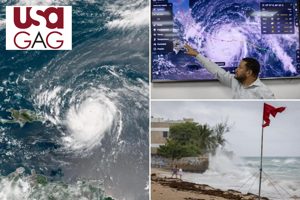
Hurricane Erin, the season’s first major storm, rapidly intensified into a Category 5 hurricane while remaining well north of the Caribbean over the weekend. The storm’s winds soared to 160 mph, classifying it as a Category 5 on the Saffir-Simpson scale. Since then, Erin has slightly weakened to a Category 4 as it reorganizes.
Impacting the northern Caribbean islands, Erin brought heavy rain and strong winds. Rainfall totals are expected to reach 2 to 4 inches through Sunday, with isolated accumulations up to six inches, risking flash flooding, urban flooding, and landslides. A Tropical Storm Watch has been issued for the Turks and Caicos, as the storm passes off to the north and east in the coming days.

Initially identified as Invest 97L, Erin was a tropical disturbance that brought heavy rains to the Cabo Verde islands, resulting in multiple fatalities and major flooding. As of now, the 2025 Atlantic season has produced four tropical storms—Andrea, Barry, Chantal, and Dexter—without any hurricanes.
Other Tropical Activity in the Atlantic
The National Hurricane Center (NHC) is monitoring a region in the eastern and central Atlantic with potential for future development. Any new cyclones are expected to form in more than a week and are likely to stay far from land during most of the remaining hurricane season.

The 2025 hurricane season’s next named storm will be Fernand, the sixth of the season. The peak of the Atlantic hurricane season occurs around September 10, with activity generally waning by November’s end.