Tropical Storm Erick Rapidly Intensifies Into Hurricane—Potential Heavy Rain Could Hit Texas!
Latest on Tropical Storm Erick
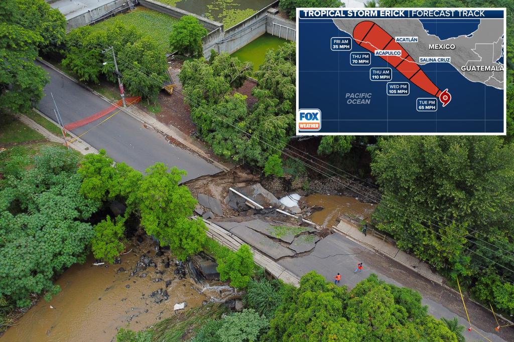
As of now, Tropical Storm Erick is gaining strength in the Eastern Pacific, located around 265 miles southeast of Puerto Angel, Mexico. The National Hurricane Center (NHC) predicts it will quickly intensify into a hurricane by Tuesday night or early Wednesday.
Currently, Erick’s maximum sustained winds are around 50 mph, and it is the fifth named storm in this year’s Eastern Pacific hurricane season. It might become the first storm to make landfall in either the Atlantic or Eastern Pacific basins this year.
Rapid Intensification Ahead
Forecasters expect Erick to strengthen rapidly before reaching land, which involves an increase in wind speeds by at least 35 mph within 24 hours. The storm could develop into a major hurricane—Categories 3, 4, or 5—if it intensifies faster than currently forecasted. It is projected to approach southern Mexico’s coast by Wednesday night, possibly making landfall on Thursday.

Mexican authorities have issued a Hurricane Warning from Puerto Angel to Punta Maldonado, with Watches extending from Punta Madonado to Acapulco and east of Puerto Angel to Bahias de Huatulco. Additionally, a Tropical Storm Watch covers areas from Puerto Angel to Salina Cruz.
NASA’s Hurricane Hunters plan to conduct three missions into Erick through Thursday for better tracking.

Potential Landfall and Rainfall
Forecasts indicate Erick will bring heavy rain to Central America and southeastern Mexico, with areas expecting 8-16 inches of rain and some pockets possibly seeing up to 20 inches, especially in Oaxaca and Guerrero. Mexican President Claudia Sheinbaum Pardo urged residents to stay informed and heed alerts as the storm approaches.
Storm surge warnings also indicate the possibility of coastal flooding, dangerous swells, and rip currents arriving by Wednesday.
Impacts Beyond Mexico
Models suggest that moisture from Erick could reach as far north as Texas later this week, potentially causing weather impacts in parts of South Texas.